GIS in Geotechnical Engineering: Unlocking the Power of Geodatabases
Published on May 10, 2025 | Bikesh Bade | 535 Views
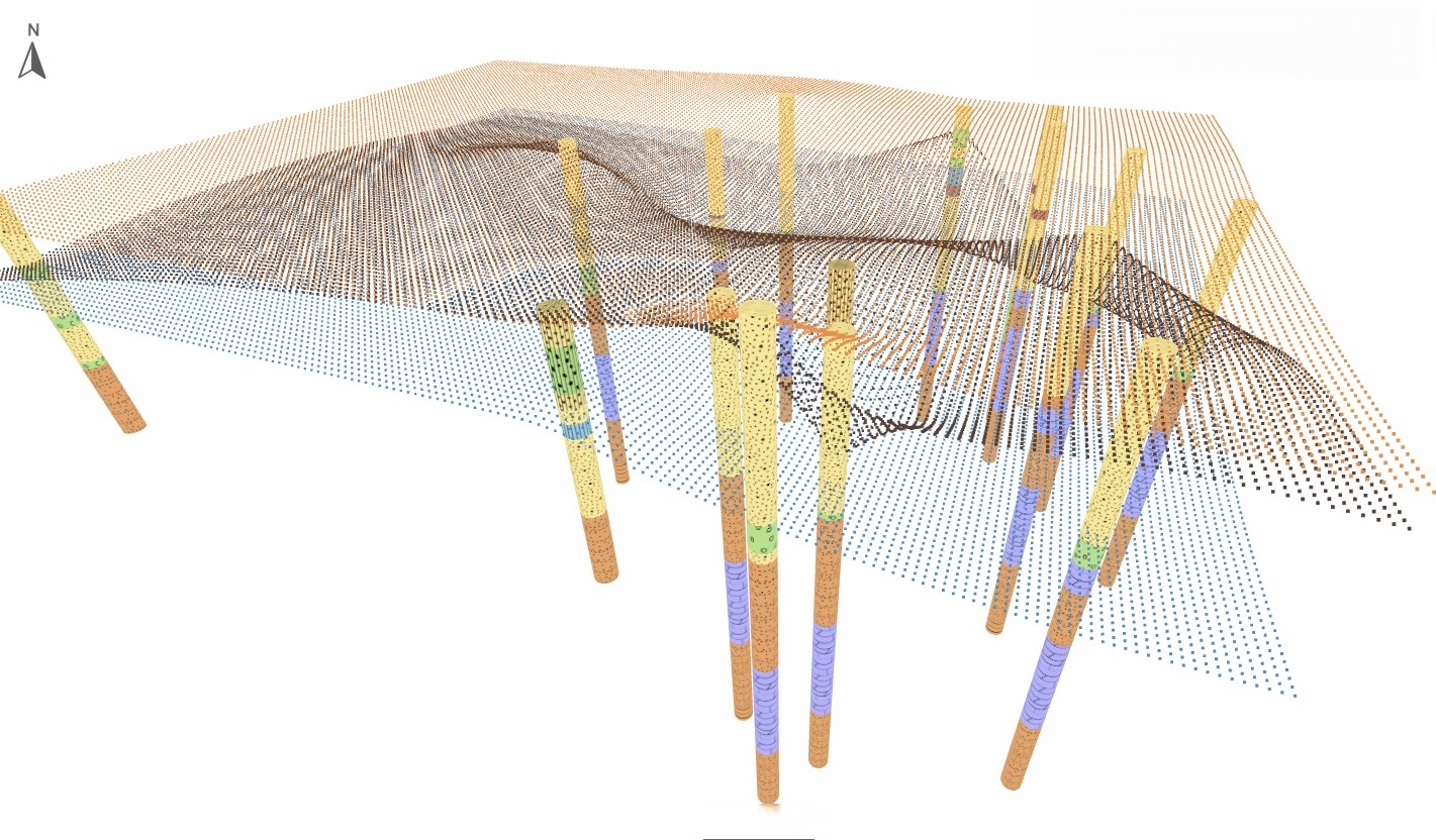
GIS enables engineers to spatially locate and analyze geotechnical data, offering insights that traditional tabular data can’t. When you map borehole locations, correlate them with soil types, and overlay terrain data, a clearer picture of subsurface conditions emerges. Platforms like https://orycta.com have embraced this intersection of GIS and geotechnical data. By digitizing borehole logs, linking them to interactive maps, and allowing 3D subsurface visualizations, Orycta enables engineers to "see beneath the surface". This transforms static PDFs into dynamic, queryable models accessible through the cloud.